1836年と現在のニューヨークを比較できる地図「This Interactive Map Compares the New York City of 1836 to Today」
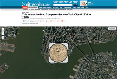
smithsonian.comが、今から約180年前の1836年と現在のニューヨークを比較できる地図を公開しています。航空写真は今のニューヨーク。そして地図上のスコープの向こうにはそのポイントの1836年の地図が見えています。
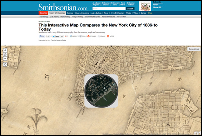
▲地図の右上「Swap Views」をクリックすると、今と昔の地図が入れ替わります。
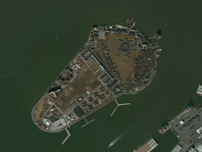
▲たとえばマンハッタンの南にあるガバナーズ島。現在ではこのような形ですが・・・
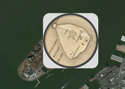
▲昔はもっと島が小さかったことがわかります。
→This Interactive Map Compares the New York City of 1836 to Today
http://www.smithsonianmag.com/history-archaeology/This_Interactive_Map_Compares_the_New_York_City_of_1836_to_Today.html
- 2013-09-05 (木) 7:44
- Web
- 1982年ニューヨークのストリートビュー|Photo Panorama Index to Street Views of New York City 1982
- 文字が木になり、言葉は森になる。Katie Holtenさん制作によるフォント「New York City Tree Alphabet」
- IBMのシニアプロダクトマネージャーだったRandy Goldenさんが語るポール・ランド「Working With Rand」
- コカ・コーラ社ドリンクのイメージカラーのネイルコレクション「OPI : Coca-Cola Collection」
- 1970年にUnimark Internationalによって設計されたニューヨーク市交通局グラフィック標準マニュアルアーカイブ「New York City Transit Authority Graphics Standards Manual」